Lecture : Vince Dziekan
Additional resources:
Culturescape information sheet
Camille Henrot Grosse Fatigue
Readings:
Cameron, Fiona. 2003. Digital Futures I: Museum Collections, Digital Technologies, and the Cultural Construction of Knowledge. Curator: The Museum Journal 46(3). 325–340. doi:10.1111/j.2151-6952.2003.tb00098.x.
[pdf]
Giaccardi, Elisa. 2012. INTRODUCTION: Reframing heritage in a participatory culture. In Giaccardi, E. (ed) Heritage and social media understanding heritage in a participatory culture, 1–10. London ; New York: Routledge.
[pdf]
Tutorial:
Going digital
In week 2, you explored your location using non-digital technologies. This week, you will revisit that location but this time you can use phones or other devices. Working on your own, you can collect various kinds of material – see below. You will share your results with one other person (unless you are happy to be more public) – you don’t have to document your personal space, you can use your street or a shared space as the basis for this exercise.
- Place your location on a digital map. A pin in Google maps is enough for now, but if you want to use the techniques you learned last week, you could also do that.
- Take photographs of the location. Ensure that you have wide-shots as well as close ups of details, and be prepared to discuss why you took particular photographs – what were you trying to capture?
- Capture sound at the location. This could be ambient sound, but it might also include talking to people about what they are doing there. If you do talk to people, make sure you obtain consent before recording anyone.
As in week 2, you will share your work in pairs. (If possible, you should have the same partner as in week 2)
- What aspects of the documentation work, what aspects don’t work?
- How does this experience compare with the analogue experience in week 2?
Be prepared to contribute to discussion of these questions.
Images, copyright, attribution:
Images and copyright: read the Monash library introduction to copyright and the Creative Commons guide to attribution. Questions we will discuss:
- When do I need to attribute an image to a source?
- How should I do that attribution?
- Are there images which I should not include in a webpage even with attribution?
- Does it matter where the page is and who can view it?
Exploring place virtually
In previous years, the exercise this week and in week 2 had you working in groups to document parts of the Monash campus. This year we will have to do the exploration virtually. We will split into groups and your starting point will be the Monash Virtual Tours page.
Instructions – research
- Choose one of the locations which has a virtual tour – we will do this before splitting up so that each group chooses a different location (big obvious features like the Library are good choices here)
- Go through the virtual tour and note features you might want to know more about
- Try to find your location on Google maps streetview – get a screenshot if you can
- Go to MONPIX and look for other images of your location
- Try to find text relevant to the location on the University’s site – or even elsewhere
Instructions – presentation
- Put your information together as a document of some sort which can be presented on a shared screen
- Check that you have appropriate attribution for images and any text you have not created yourselves
- Be ready to present your work to the rest of the class and to comment on any problems which you encountered
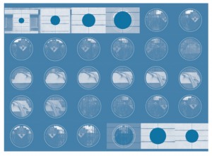
Header Image: The Ammonite Cycle 6, 2008, Vince Dziekan (storyboard visualization of portable media content motion graphic, 320x240p, 60secs, designed for delivery via iPod)